Landscape of Costa Rica Now and in the Distant Future

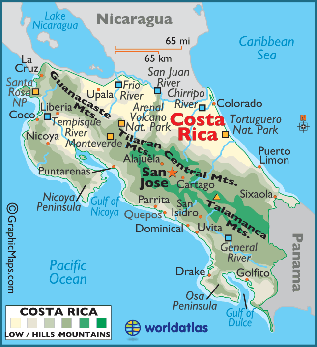
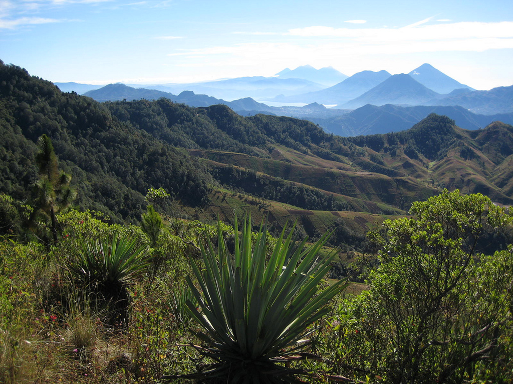
General Landscape of Costa Rica

Costa Rica is a unique landscape that boasts everything from coastal lowlands, to breathtaking cloud forests, to towering volcanoes. These volcanoes take up much of the country, and much of the Central American Isthmus. This chain of volcanoes, the Central America Volcanic Arc, exists due to the subduction of the Cocos plate underneath the Caribbean plate. Although this is the primary plate boundary that causes this volcanic arc to keep growing, there are actually five different plate boundaries in this area of the globe. This means that there’s a ton of tectonic activity in and near Costa Rica, such as earthquakes and volcanic eruptions. The Cocos and Caribbean convergent plate boundary caused Costa Rica’s four volcanic mountain ranges to form.  Part of this volcanic range is a horst due to extreme block-faulting. On the other side of this arc of volcanoes, the Arenal graben and the Valle Central make up a basin. The northern coastal plains of the country were formed millions of years ago from sediment and alluvial river deposits, some from Lake Nicaragua. Alluvial deposits are also plentiful due to the heavy rain that falls at higher altitudes and then flows down the mountain depositing sediment. These deposits are also partially comprised of heavy volcanic mudflows and a whole lot of volcanic ash due to the large amount of active volcanoes in Costa Rica.

Subduction of the Cocos plate under the Caribbean plate results in the Central America Volcanic Arc. Photo  from http://sio.ucsd.edu/volcano/expedition/cocos.html.

Subduction of the Cocos plate under the Caribbean plate results in the Central America Volcanic Arc. Photo from http://sio.ucsd.edu/volcano/expedition/cocos.html.

Earth’s surface is always shifting due to movement of the plates and a whole slew of environmental factors such as weathering and erosion. We’ve seen what drastic changes can occur in just a short amount of time, such as when a volcano erupts. But what about the changes that will inevitably happen after we’re long gone?

Landscape of Costa Rica in 10,000 years

In 10,000 years, Costa Rica could look fairly different. The Cocos plate is currently moving at a rate of 9 centimeters per year in a northwest direction, subducting underneath the Caribbean plate. This means that in 10,000 years, the plate will have moved about 0.9 kilometers.  I predict that Costa Rica’s volcanoes will remain active, and it is plausible that several new volcanoes will also form due to the large amount of subduction occurring at the plate boundaries. This may make it a poor choice for human inhabitance in the future.

Landscape of Costa Rica in 1,000,000 years

In 1,000,000 years, Costa Rica may look drastically different. By this time, the Cocos plate will have moved roughly 90 kilometers. Costa Rica formed as a string of volcanic islands that filled in around the bases over several million years. Based on this, I predict that the narrow land bridge will widen due to sea floor spreading and increased volcanic activity from the 90 kilometers of plate movement. The mountain ranges could also increase greatly in height, as evidence suggests that they have only reached their current height in the last two million years.

Subduction can be clearly seen in dark blue, as volcanic mountains are shown in red. The isthmus shows signs of widening above sea level in the future, in orange. photo from http://joidesresolution.org/node/1810.

Subduction can be clearly seen in dark blue on both Cocos and Caribbean plates. The isthmus shows signs of widening above sea level in the future, in orange. photo from http://joidesresolution.org/node/1810.

Landscape of Costa Rica in 100,000,000 years

In 100,000,000 years, it’s almost impossible to fathom what Costa Rica might look like. The whole planet will be unrecognizable (if it’s still around). I predict that the isthmus will widen significantly because the zone of subduction will have moved a great deal, as will the point of origin for new volcanoes. At this point, the Cocos plate will be 9000 kilometers from where it is today, if it continues to move in the same direction and speed. This would cause the mountains to continue to increase in height. I predict that many new active volcanoes will form over this time period because of the movement of the plates overlapping so severely.  I also think that the northern plains will continue to receive many alluvial and volcanic deposits.

Billions of years from now, I do not think that Costa Rica will be the paradise for flora and fauna that it currently is. Movements of the plates will drastically change this landscape, but only time will tell how that happens specifically.

Climate Patterns of Costa Rica

Costa Rica lies just north of the equator at 10º N, so it is just above the ITCZ, or Intertropical Convergence Zone. In the global pressure gradient, the subtropical high pressure is at 30º N. Costa Rica is in between this subtropical high and the ITCZ, so since air flows from high to low pressure, the country experiences strong Northeast trade winds. These trade winds flow from the subtropical high to the ITCZ and due to the Coriolis effect, they flow from north to east.

As illustrated above, the c Coriolis effect combines with the high to low pressure gradient to give Costa Rica northeast trade winds. photo from http://blogs.unpad.ac.id/anggameidia/files/2012/10/angin-pasat.jpg.

As illustrated above, the Coriolis effect combines with the high to low pressure gradient to give Costa Rica northeast trade winds. photo from http://blogs.unpad.ac.id/anggameidia/files/2012/10/angin-pasat.jpg.

However, the ITCZ rises and falls in latitude seasonally, so it is much further north and therefore closer to Costa Rica in July. This brings the global belt of clouds and precipitation with it, and so Costa Rica consequentially receives a high amount of precipitation during the summer. The country’s average annual rainfall is roughly 100 inches, but some areas receive as much as 25 feet of precipitation. Given this astounding amount, it is not surprising that many farmers are continuously battling erosion. There are only two distinct seasons visible: the Green (rainy) season, which lasts from May to November, and the High (dry) season from December to April. In several areas, due to Costa Rica’s unique microclimate, these seasons are switched such as in the northern lowlands.  The Caribbean coast of Costa Rica does not receive a distinct dry season due to its position on the windward side of the country.

As pictured above, the northern Pacific regions receive far less rain than the Caribbean coast. picture from http://retireforlessincostarica.com/2014/06/retire-for-less-newsletter-june-30-2014/.

As pictured above, the country receives an astonishingly high amount of rain. picture from http://retireforlessincostarica.com/2014/06/retire-for-less-newsletter-june-30-2014/.

The above mentioned trade winds keep Costa Rica warm and humid for most of the year. They bring warm, moist air from the Caribbean. This air is on its way to the ITCZ, however the central mountain range pushes it upward. This results in orographic lifting, and so precipitation falls heavier on the windward side of the country. The forecast of Costa Rica’s Pacific coast is consistently drier due to it’s leeward positioning.

Orographic lifting due to the central mountain ranges result in a rainier Caribbean coast and a drier Pacific coast. photo from http://costa-rica-guide.com/travel/index.php?option=com_content&task=view&id=365&Itemid=604&limitstart=7

Orographic lifting due to the central mountain ranges result in a rainier Caribbean coast and a drier Pacific coast. photo from http://costa-rica-guide.com/travel/index.php?option=com_content&task=view&id=365&Itemid=604&limitstart=7

Extrusive Landforms and Soil of Costa Rica

Costa Rica currently has five active volcanoes. The first, Turrialba, is a stratovolcano that has caused damage to the surrounding agricultural areas due to pyroclastic flows and ash fall. Poas is another stratovolcano that has a green acid lake in its crater. During frequent phreatic eruptions, water shoots out of this lake resembling a geyser. Rincon de la Vieja is a complex volcanic ridge that erupts in nine different locations, the main one also possessing an acid lake. Arenal is an andesite stratovolcano that is accumulating a growing lava dome due to nearly continuous eruption activities. Irazu is an enormous stratovolcano that has produced heavy tephra causing heavy damage to San Jose. It too has an acid crater lake.  In fact, acid rain falls near most of these, and lakes have formed in the summit craters.

Mass wasting is an ongoing process on Irazu, especially in the crater where rockslides can change the color of the acid lake from green to reddish tones. Photo from www.monteverdetours.com.

Mass wasting is an ongoing process on Irazu, especially in the crater where rockslides can change the color of the acid lake from green to reddish tones. Photo from http://www.monteverdetours.com.

Irazu is vital to Costa Rica’s ecosystem and agricultural industry because of its rich and fertile volcanic soil. Unfortunately, soil erosion due to water runoff is making the soil much less fertile. The steep slopes of Irazu only contribute to the runoff problem. Since Costa Rica gets such extreme rain, nutrients and sediments are quickly carried down the mountain.

To prevent the stripping of this fertile volcanic soil, farmers have implemented contour farming techniques. Photo from http://www.ipsnews.net/2014/03/costa-rican-farmers-become-climate-change-acrobats/.

To prevent the stripping of this fertile volcanic soil, farmers have implemented contour farming techniques. Photo from http://www.ipsnews.net/2014/03/costa-rican-farmers-become-climate-change-acrobats/.

Costa Rica has a wide array of soil classifications. In the East Central Plateau of  Costa Rica, there are three main types: umbric andosol, which is a volcanic soil; and two eutric cambisols, which are also considered inceptisols meaning they are young. The umbric andosol is found on the slopes of Irazu and many other parts of Costa Rica. The first eutric cambisol is a dark brown loam rich in organic material and is located at an alluvial fan of the Reventazon river. The second cambisol is quite similar, but with more distinct stratifications of the alluvial sediment deposits.

4047853

Umbric andosols have an extremely thick A horizon composed of volcanic ash deposition (which can be seen above) and are high in acidity, organic material and biological activity. (Lower-montane cloud forest in Monteverde.) Photo from http://www.jesse-robinson.com/research.html. 

Costa Rica’s Mountain Ranges

But first, some background on Costa Rica. It’s located in Central America, south of the Tropic of Cancer, and is roughly 600 miles north of the Equator. The capital, San José, is at 10° N and 84° W.

crcolor

Map from WorldAtlas.com

The country of Costa Rica is home to the lowest part of the majestic Sierra Madre mountains, which stretch up to Mexico. They were formed volcanically at the intersection of five tectonic plates where Central America is today. The Coco’s plate subducted underneath the Caribbean plate, which created an arc of volcanic islands. After years of volcanic activity, these filled out with land and became the isthmus that is now Central America.

Volcanic peaks of Guanacaste mountains. Photo from plate-tectonics.narod.ru

Volcanic peaks of Guanacaste mountains. Photo from plate-tectonics.narod.ru

Although the volcanic mountain formation dates back 65 million years ago, the land bridge is only about 3 million years old. The section of this volcanic belt that lies in Costa Rica is separated into four individual mountain ranges. These are the Guanacaste Mountains, Costa Rica’s northernmost mountain range; the Tilaran Mountains and the Central Mountains, both located in the midsection of the country; and the Talamanca Mountains in the southeast.

Veragua Rainforest in Talamanca Mountains. Photo from veraguarainforest.com

Veragua Rainforest in Talamanca Mountains. Photo from veraguarainforest.com

Costa Rica’s highest peak is called Cerro Chirripo, located in the northern Talamanca Mountains. Cerro Chirripo stands 12,500 feet tall.  This peak is worth mentioning in my opinion because it’s not only the highest point in Costa Rica, but it is also the highest point in over a thousand miles between Guatemala’s volcanoes and the Andes Mountains in South America.

Photo from www.summitpost.org

View from the summit of Cerro Chirripo. Photo from http://www.summitpost.org

The Sierra Madre mountains still show tons of volcanic activity today due to the ever-shifting tectonic plates and subduction occurring below Central America. There are over 200 volcanic formations in Costa Rica, but only 5 of those are currently considered active ones. They are the Turrialba, Poás (which erupted in February), Rincón de la Vieja, Arenal, and Irazú.

Sierra Madre mountain range and volcanic chain date back up to 65 million years ago. Photo from http://plate-tectonic.narod.ru

Sierra Madre mountain range and volcanic chain date back up to 65 million years ago. Photo from http://plate-tectonic.narod.ru

Welcome to my blog!

Hi there, my name’s Marcelle McCaslin. I’m originally from the Bay Area in California, and moved to Denver last year to start school. I’m currently a sophomore at UCD, majoring in geography and minoring in studio art. Although I’m a sophomore, I only began studying geography this semester (I was previously a psychology major). So I’m extremely excited to start exploring the fantastic features of the world through the eyes of a geographer!

I chose to study Costa Rica, mainly because I want to visit the rainforest as soon as I possibly can. Costa Rica is home to miles of lush rainforest, as well as jagged mountain ranges and active volcanoes. One of these volcanoes, Arenal, erupts almost every single day! I can’t wait to discover more about the diverse landscape that Costa Rica boasts. Eventually I’ll see the landforms mentioned in this blog through my own two eyes, but until then, photographs and research will have to suffice.

Central-America-Costa-Rica-Jewels-9-volcano